 Worlds of Stone: 10/19/2011
As part of the current show (Worlds of Stone) at Pacific Science Center we’re updating the images we show from NASA’s MESSENGER and Dawn missions on a weekly basis. I’ll try to show them to you the week after we use the in the planetarium.
Dawn
NASA Caption
Released October 11, 2011
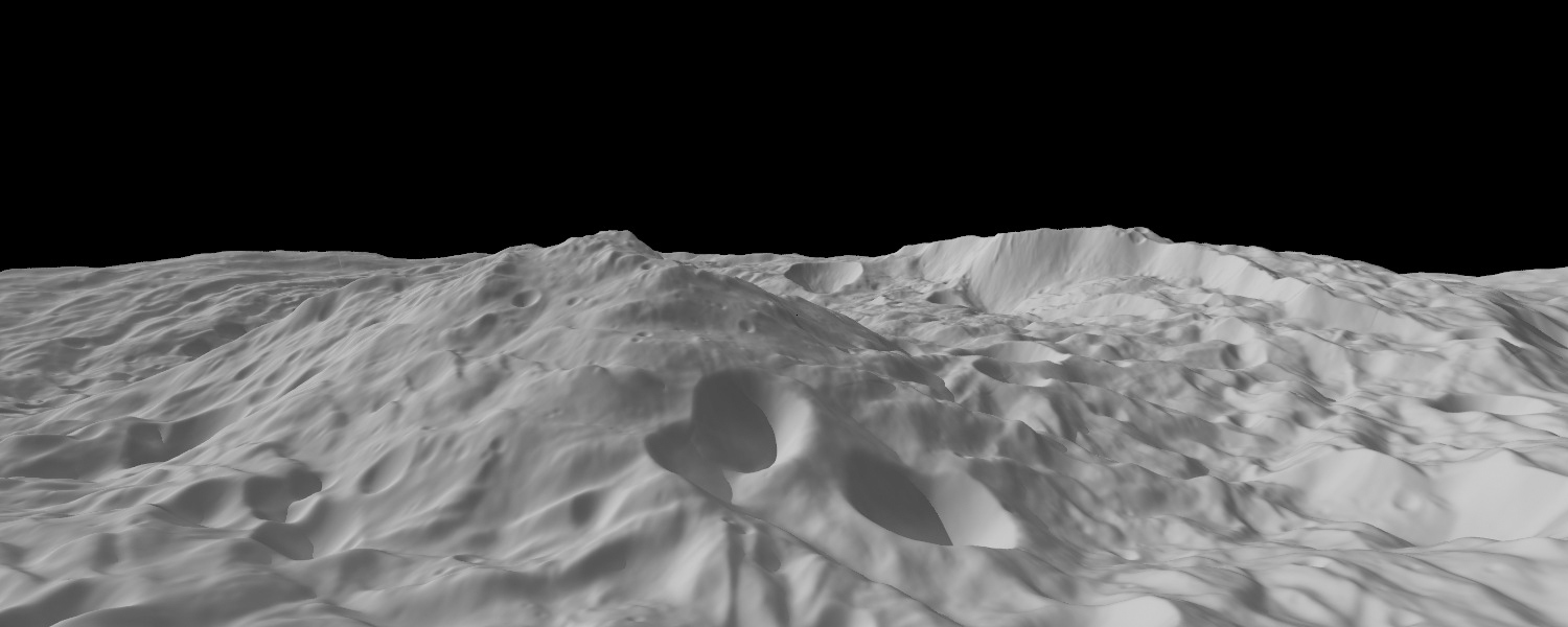
PASADENA, Calif. — A new image from NASA’s Dawn spacecraft shows a mountain three times as high as Mt. Everest, amidst the topography in the south polar region of the giant asteroid Vesta.
The peak of Vesta’s south pole mountain, seen in the center of the image, rises about 13 miles (22 kilometers) above the average height of the surrounding terrain
Another impressive structure is a large scarp, a cliff with a steep slope, on the right side of this image. The scarp bounds part of the south polar depression, and the Dawn team’s scientists believe features around its base are probably the result of landslides.
This image was created from a shape model of Vesta, and shows an oblique perspective view of the topography of the south polar region. The image resolution is about 300 meters per pixel, and the vertical scale is 1.5 times that of the horizontal scale.
Alice Says
NASA’s caption is pretty clear, most important is to note that THIS IS A CGI IMAGE, and it is vertically exaggerated 1.5 times. This mountain is measured from the average height of the ground around it.
MESSENGER

Lava Flow on Mercury Credit: NASA/Johns Hopkins University Applied Physics Laboratory/Carnegie Institution of Washington
NASA Caption
Date acquired: April 20-22, 2011
Release Date: October 17, 2011
Instrument: Wide Angle Camera (WAC) of the Mercury Dual Imaging System (MDIS)
Of Interest: This mosaic shows the geological contact between a lava flow front, which advanced from the west (left) and the pre-existing terrain that it covered. The lava flowed into and almost completely filled a medium-sized crater in the center of the scene. Other amazing lava flow features were shown in recent Gallery releases.
Alice Says
NASA’s caption says you can see an ancient, solidified lava flow here, and you can see how it covers the land behind it. The front is just like the crest of a water wave – only this was a wave in rock and it froze in place as the lava solidified.
It is a little hard to tell which is the lava flow front here – the line that runs vertically through the image, or the one that runs horizontally. They cross exactly in the middle of the image. NASA’s caption is talking about the vertical line. You can see the crater they’re talking about – you can only see the top right-hand quarter of the rim of the crater, just above where the two lines cross.
Want More?
Worlds of Stone at Pacific Science Center
![]()
~ A l i c e !


